How PW Atlas Book Simplifies Indian and World Geography for UPSC Students?

Memorising global shipping lanes, tracing twisting national river systems, and locating remote volcanic islands from text-heavy textbooks can quickly lead to mental exhaustion. Visualising these details accurately is a significant hurdle that standard reference books cannot easily resolve on their own.
This is where a highly visual, exam-aligned Atlas book for UPSC becomes an indispensable resource, transforming abstract geographical theories into clear, easily digestible visual maps that stay with you long after you close the book.
Overview of Atlas for UPSC
Geography is an inherently visual discipline that cannot be mastered merely by reading descriptive passages. An exam-oriented atlas book for UPSC serves as a vital bridge, connecting theoretical concepts with actual spatial layouts.
The atlas is designed specifically to meet this need, providing a systematic layout that caters directly to the evolving pattern of the civil services exam.
Unlike conventional reference UPSC books that overload pages with cluttered text, this resource organises spatial information into clean, thematic layers. The atlas covers everything from physical landscapes and international borders to dynamic economic corridors.
Why Is Atlas for UPSC Important for Geography Preparation?
In both the Preliminary and Mains stages of civil services testing, map-based questions carry significant weight. Without a structured atlas for UPSC geography, interpreting questions about international borders, mineral distribution, or river basins becomes incredibly difficult.
|
Exam Stage |
Core Utility of Atlas |
Impact on Final Score |
|
Prelims |
Direct questions on national parks, passes, rivers, and international conflict zones. |
Helps secure 15-20 crucial marks through direct factual accuracy. |
|
Mains |
Illustrating answers with quick, hand-drawn maps of geographical features. |
Adds an extra 1-1.5 marks per question by improving visual presentation. |
Difference between Indian Geography and World Geography in Atlas for UPSC
Mastering geography requires a balanced approach that distinguishes between local and international spatial patterns. An effective world atlas for UPSC must contrast micro-level national details with macro-level global connections.
1. Indian Geography Highlights
The Indian section focuses deeply on regional topography, resource distribution, and administrative structures:
-
Physical Features: Detailed breakdowns of the Himalayan peaks, coastal plains, central plateaus, and major river basins.
-
Socio-Economic Data: Visual representations of agricultural patterns, mineral reserves, industrial clusters, and transport networks.
-
Political Boundaries: Clear markings of state borders, union territories, and contested international boundaries.
2. World Geography Highlights
The global section shifts the focus toward broad physical features, international relations, and global trade:
-
Global Physical Layout: Key mountain chains, major deserts, ocean currents, and climatic zones across all continents.
-
Geopolitical Hotspots: Clear mapping of international bodies of water, strategic canals, choke points, and regions frequently in the news.
-
Global Connections: Wind patterns, global trade routes, and international environmental conservation areas.
How to Use Atlas for UPSC?
To get the absolute most out of your UPSC study material, you need a systematic approach rather than just randomly flipping through pages. Here is a step-by-step method to incorporate the atlas into your daily routine:
Step 1: Coordinate with the Syllabus
Never study the atlas in isolation. When you read a theoretical chapter on the drainage system of India in your textbook, open the corresponding river maps in the atlas immediately. Trace the origin, tributaries, and final outlets of the rivers to anchor the text visually.
Step 2: Practice Active Map Drawing
Use the 60-second map drawing techniques included in the atlas. Being able to quickly sketch a rough map of India or Africa is a massive advantage in the Mains exam, allowing you to illustrate points like resource distribution or river basins rapidly.
Step 3: Solve Map-Based Questions
Do not just look at the maps; put your knowledge to the test. Work through the 200+ practice questions and use the provided outline maps to fill in physical features, state borders, and historical sites from memory.
Benefits of Using Atlas for UPSC
Using a structured UPSC atlas book offers several distinct advantages over standard resources. The atlas is not just a collection of locations; it is an active study tool designed to improve visual recall and conceptual clarity.
1. Conceptual Visualisation and Recall
Human brains process visual images significantly faster than written text. By presenting geographical facts through clear, high-definition cartography, the atlas helps you build a strong mental map of the world. This makes it much easier to recall precise locations during high-pressure exam situations.
2. Exam-Centric Features
This book integrates unique features that directly address the specific demands of civil services examinations:
-
Quick-Reference Sections: Dedicated sections detailing key geographical facts, statistics, flags, and glossary terms.
-
Speed Drawing Techniques: Innovative guides that teach you how to sketch key continental outlines and Indian state boundaries in under 60 seconds.
-
Map-Based Practice: Over 200+ questions designed to test both your factual recall and analytical geography skills.
UPSC PYQ Book help aspirants understand the latest exam trends, question patterns, and important topics through authentic previous year questions. With detailed solutions and chapter-wise practice, these books improve conceptual clarity, accuracy, and confidence for UPSC Prelims and Mains preparation.
Study Plan for Using Atlas for UPSC
Building a long-term memory of geographical data requires consistency and structure. Here is an actionable weekly strategy you can use to make map study a natural part of your routine:
-
Daily Visual Check (15 Minutes): Spend 15 minutes reviewing the poster-sized physical wall map of India. Focus on a specific region each day, such as the Northeast or the Western Ghats.
-
Weekly Thematic Study (2 Hours): Dedicate a block of time each week to a single theme, such as global ocean currents, mountain passes of India, or national mineral belts.
-
Current Affairs Integration: Whenever a location is mentioned in international news (such as a port, a strait, or a conflict zone), look it up in your atlas immediately. Mark its surrounding seas, neighboring countries, and strategic importance.
-
Avoid Digital-Only Overreliance: While studying with an atlas for UPSC PDF on a tablet can be useful for quick lookups on the go, nothing compares to the spatial memory built by working with a physical, tactile page. Use the physical atlas book to truly cement spatial layouts in your mind.
Common Mistakes to Avoid While Using Atlas for UPSC
Many students spend countless hours studying maps without seeing a significant improvement in their test scores. This is usually due to common study mistakes that can easily be avoided:
-
Passive Reading: Simply looking at a map without actively quizzing yourself or trying to draw the boundaries leads to very low retention.
-
Ignoring Current Affairs: UPSC rarely asks about random locations; questions are almost always linked to areas of recent geopolitical or environmental significance.
-
Overloading Maps with Highlighters: Covering your atlas pages in a sea of neon yellow and green makes it incredibly difficult to read the actual geographic labels. Use color-coded notes sparingly.
-
Neglecting the Glossary and Statistics: The facts, figures, and glossary sections at the back of the Informative Atlas contain vital contextual data that can be extremely helpful for answering Prelims questions.
Read More: Which NCERT Books are Required for UPSC Exam Preparation?
Atlas for UPSC FAQs
Which is the most suitable atlas for UPSC preparation?
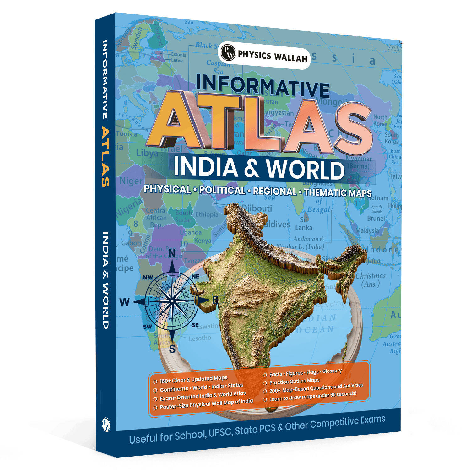
The Informative Atlas (2026 Edition) is highly recommended because it includes over 160+ updated maps, 200+ practice questions, simple 60-second map-drawing techniques, and a large poster-sized physical wall map of India specifically designed for competitive exams.
How often should I study the Atlas book for UPSC?
You should integrate map study into your daily routine. Spending 15 to 20 minutes a day actively reviewing maps alongside your daily current affairs and core textbook reading is much more effective than cramming for hours right before the exam.
Can I rely solely on an atlas for UPSC PDF during my preparation?
While digital files are convenient for quick references, using a physical book is highly recommended. A physical atlas helps build superior spatial and muscle memory, which is essential for accurate location-based answers and hand-drawn maps in the Mains exam.
Why is a world atlas for UPSC necessary for current affairs?
Many UPSC questions focus on international geopolitical hotspots, major maritime trade routes, straits, and border disputes. A world atlas helps you instantly locate these regions, allowing you to understand the underlying strategic and geographical context of global news.
What makes the UPSC atlas book different from standard books?
Unlike traditional atlases, this book is specifically structured for exam aspirants. It features simplified map-drawing guides, factual glossaries, world flags, and over 200+ targeted practice questions that actively test and reinforce your geographical knowledge.