How to Master Indian States, Capitals, Rivers, and Mountains Using PW Atlas Book?

Memorising every single state capital, the winding pathways of major river basins, and the precise sequence of mountain peaks is a common hurdle that leaves many aspirants feeling lost. Without a structured spatial strategy, geographical facts can easily blur together, leading to costly mistakes under exam pressure.
This comprehensive article shows you exactly how to navigate an Atlas book for UPSC to build a strong mental map of India. By dividing your study sessions into manageable thematic layers, you will learn to connect political boundaries with physical landmarks effortlessly.
What is the Atlas Book for UPSC?
An atlas book for UPSC is a specialized, highly visual learning aid designed to translate abstract geographical data into clear, spatial layouts. Unlike standard reference textbooks that rely on dense paragraphs of descriptive text, an atlas uses political, physical, and thematic maps to establish clear spatial contexts.
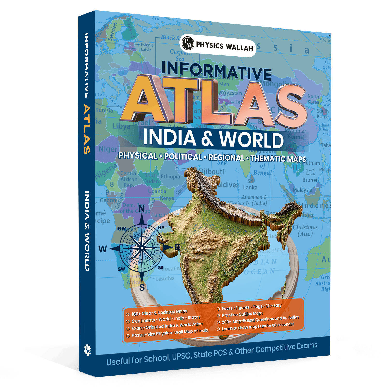
The comprehensive resource provides a detailed visual layout of both national and global geography. It serves as a vital bridge between conceptual theory and spatial reality. A high-quality UPSC atlas book contains several core elements:
-
160+ Updated Maps: Clear, highly accurate visual maps covering vital geopolitical and physical boundaries.
-
Geographical Facts and Figures: Structured data points, essential statistics, and global flags to aid quick learning.
-
A Dedicated Glossary: A quick-reference section that simplifies complex geographical terminology.
-
Interactive Practice Elements: Over 200 map-based questions and practice outline maps to test retention.
-
Bonus Visual Resources: A large, poster-sized physical wall map of India to support continuous, passive visual learning.
Why Is Atlas Book for UPSC Useful?
Studying geography without visual aids is like trying to navigate an unfamiliar city without a navigation app. An atlas for UPSC acts as your spatial guide, converting dry factual details into memorable visual patterns. This approach is highly effective because human brains process and retain visual information far more efficiently than plain text.
-
Improved Location-Based Accuracy
Competitive exams increasingly test your spatial precision. Questions often require you to identify border-sharing states, arrange capital cities from north to south, or locate specific ecological zones. Using a dedicated atlas helps you build strong location-based accuracy, ensuring you can pinpoint precise coordinates and boundaries confidently.
-
Integrated Prelims and Mains Preparation
Mapping is not just about solving multiple-choice questions. It provides the structural backbone for your descriptive answers, too. By regularly studying an atlas for UPSC geography, you learn how physical features like mountain ranges influence climate, agriculture, and trade. This deep conceptual understanding helps you draft well-structured answers for both stages of the examination.
-
Quick-Reference Tools for Rapid Revision
When exams are just around the corner, reading through thousands of pages of notes is highly impractical. The built-in facts, figures, and glossary sections in a modern atlas allow you to revise critical spatial details rapidly. Having these structured layouts consolidated in one place saves precious time during final revisions.
To make your preparation more comprehensive, combine your atlas with UPSC Books, which offer complete subject-wise coverage, conceptual explanations, practice questions, and revision material aligned with the latest UPSC syllabus. Using both resources together helps build stronger conceptual understanding, improve map-based learning, and prepare effectively for both the UPSC Prelims and Mains examinations.
How to Study States and Capitals in the Atlas Book for UPSC
Successfully memorising political boundaries requires a highly systematic approach rather than random, unstructured reading. You should start by focusing on regional clusters to prevent information overload and build clear mental boundaries.
Step 1: Divide the Map into Regional Clusters
Do not try to memorize the entire Indian map in a single study session. Instead, break the political map down into five logical regional clusters:
-
The Northern & Himalayan Zone: Jammu & Kashmir, Ladakh, Himachal Pradesh, Uttarakhand, and Punjab.
-
The North-Eastern States: Focus closely on the "Seven Sisters" and Sikkim, paying special attention to international borders.
-
The Peninsular South: Karnataka, Andhra Pradesh, Telangana, Tamil Nadu, and Kerala.
-
The Central & Western Belt: Rajasthan, Gujarat, Maharashtra, Madhya Pradesh, and Goa.
-
The Eastern Plains: Bihar, West Bengal, Odisha, Jharkhand, and Chhattisgarh.
Step 2: Establish Relative Cardinal Positions
Once you have selected a regional cluster, do not just look at the names. Ask yourself specific structural questions to establish relative positions:
-
Which capitals lie closest to the Tropic of Cancer?
-
If you travel from Gandhinagar to Kolkata in a straight line, which states would you cross?
-
Which state capitals are located furthest east or west within their respective regions?
Step 3: Practice with Outline Maps
After studying a specific political region in your world atlas for UPSC, close the book and open a blank outline map. Try to write down the state names and mark their capitals from memory. This active recall practice helps transition information from your short-term memory into long-term retention.
Stay updated with the UPSC Quarterly Current Affairs Combo 2026 by Aasim Sir, offering quarter-wise coverage of important national and international events, government schemes, reports, editorials, and issue-based analysis for effective UPSC Prelims and Mains preparation.
How to Study Rivers and Mountain Ranges in the Atlas Book for UPSC?
Physical geography requires you to understand the flow, elevation, and connections of natural landscapes. To master these features, you must learn to read the physical maps in your atlas for UPSC in structured, thematic layers.
1. Mapping the Mountain Ranges
To study mountain systems effectively, always follow a specific path of elevation rather than looking at scattered peaks:
-
Trace the Himalayan Arcs: Move systematically from the Trans-Himalayas down to the Outer Himalayas (Shiwaliks). Note the relative positions of major peaks like Kanchenjunga and Nanda Devi.
-
Analyze Peninsular Hills: Compare the continuous, high-elevation stretch of the Western Ghats with the highly dissected, lower-elevation Eastern Ghats.
-
Locate Key Mountain Passes: Identify the crucial gaps (such as Nathu La, Shipki La, or Palakkad Gap) that cut through these massive ranges, as these are highly popular exam topics.
2. Tracking River Systems
Water bodies should always be mapped from their origin to their end point. Avoid looking at rivers as simple, isolated lines on a page:
-
Separate Major Basins: Distinguish clearly between Himalayan rivers (like the Indus, Ganga, and Brahmaputra) and Peninsular rivers (like the Godavari, Krishna, and Narmada).
-
Identify Flow Directions: Group rivers by where they drain. Note which systems flow west into the Arabian Sea and which flow east into the Bay of Bengal.
-
Map the Tributaries: Trace where major tributaries join the main river. Use simple, hand-drawn tree diagrams to visualize left-bank and right-bank tributaries clearly.
Study Plan for Using the Atlas Book for UPSC
Consistency is key to mastering geography. A structured, multi-week preparation plan will help you cover the entire syllabus systematically without feeling overwhelmed.
|
Week |
Study Focus |
Mapping Goal |
Active Learning Activity |
|
Week 1 |
Indian Political Boundaries |
Memorize all 28 states, 8 Union Territories, and their respective capital cities. |
Fill out 3 blank political outline maps from memory. |
|
Week 2 |
Himalayan & Northern Rivers |
Trace the complete paths, origins, and major tributaries of the Indus, Ganga, and Brahmaputra. |
Draw simplified river basin flowcharts in under 60 seconds. |
|
Week 3 |
Peninsular River Systems |
Map the major East and West-flowing rivers of the southern peninsula. |
Compare tributary networks using a structured side-by-side table. |
|
Week 4 |
Major Mountain Systems |
Study the Himalayas, Aravalis, Vindhyas, Satpuras, Western Ghats, and Eastern Ghats. |
Label key peaks, passes, and elevation heights on a blank physical map. |
Also Check, UPSC Previous Year Papers
Revision Tips Using the Atlas Book for UPSC
Retaining geographical details requires regular, active practice. Simple passive reading is rarely enough to keep these complex details fresh in your mind.
1. Use the 60-Second Map Drawing Technique
One of the most effective ways to test your spatial memory is learning to draw a basic outline map of India in under a minute. Do not worry about perfect artistic accuracy. Focus instead on capturing correct relative proportions. Once your basic outline is drawn, practice quickly sketching in a specific feature, such as the course of the Ganga or the location of the Western Ghats.
2. Leverage the Power of Passive Visual Learning
Hang the poster-sized physical wall map of India in a place where you spend a lot of time, such as right above your study desk. This allows you to review geographical features passively during study breaks. Simply glancing at the map for a few minutes every day helps reinforce spatial boundaries and physical layouts without any extra effort.
3. Test Yourself with Active Practice Questions
Do not skip the map-based practice questions included in your atlas. Answering structured questions forces your brain to retrieve stored spatial details, highlighting any gaps in your memory before the actual exam.
Enhance your UPSC preparation with an UPSC PYQ Book that brings together authentic previous year questions, detailed explanations, and chapter-wise practice in one place.
It helps you understand question trends, identify high-priority topics, strengthen concepts, and improve your problem-solving approach for both the UPSC Prelims and Mains.
Common Mistakes While Studying with the Atlas Book for UPSC
Avoiding common mistakes while using the Atlas Book for UPSC can make your preparation more effective and improve long-term retention. A focused study approach helps you understand geographical concepts and apply them accurately in the examination.
-
Relying Solely on Digital Maps: While digital files like an atlas for UPSC PDF are highly convenient for quick lookups on the go, they lack the physical presence needed for deep spatial study. Working with a physical, paper atlas makes it much easier to flip between different thematic maps and build a lasting mental layout.
-
Passive Scanning Without Practice: Simply looking at a pre-marked map can give you a false sense of security. You might feel like you know the material, but you only truly master it when you can reproduce those locations on a blank outline map.
-
Ignoring the Map Legend and Scales: Every map uses specific colors, symbols, and scales to represent elevation, water depth, and boundaries. Skipping these keys can lead to major misunderstandings about terrain heights and actual physical distances.
-
Studying Geography in Isolation: Geography does not exist in a vacuum. Always try to connect physical landscapes with historical events, economic trade routes, and current affairs to build a complete, integrated understanding of the subject.
Read More: UPSC Previous Year Question Papers PYQ PDF with Downloaded Solutions
Atlas Book for UPSC FAQs
How does an atlas book for UPSC help with daily current affairs?
An atlas allows you to immediately locate places mentioned in daily news reports. Finding these cities, rivers, or international borders on a map provides immediate spatial context, making current affairs far easier to understand and remember.
Can I prepare for geography without a physical UPSC atlas book?
While digital resources can be helpful for quick lookups, a physical atlas is highly recommended. Physical maps allow you to easily compare different regions, write down personal notes, and build a much stronger, long-lasting mental map of geographical layouts.
What is the best way to memorize tributaries using an atlas for UPSC?
The best approach is to draw simplified, hand-drawn tree diagrams. Trace the main river channel as a thick central line, then add left-bank and right-bank tributaries as branches. This simple visual layout is much easier to remember than a long, written list.