Features of PW Atlas Book for 2026 Exam Preparation

Many candidates spend hours reading endless pages of geography textbooks, yet they fail to convert that theoretical knowledge into high scores because they cannot visualise the actual locations.
This disconnect becomes a major hurdle when dynamic current affairs questions require you to pinpoint precise global conflict zones or international trade corridors on the spot.
Finding the right Atlas Book for UPSC preparation is the single most effective way to solve this problem, transforming confusing spatial data into clear, easily remembered mental pictures.
What Is Atlas for UPSC?
Civil Services aspirants frequently encounter highly detailed location-based questions that test their grasp of national and international geography. An Atlas for UPSC is not just a standard collection of maps but a structured visual database designed specifically to bridge the gap between static textbook theory and dynamic real-world events.
It compiles comprehensive spatial information that transforms dense text into clear, memorable visual diagrams. For candidates aiming at the competitive civil services exam, a dedicated world Atlas for UPSC covers the entire global landscape while diving deeply into regional intricacies.
This specialised book assists you in identifying physical features, understanding geopolitical shifts, and observing international boundaries that regularly feature in the news. It is an indispensable guide for any candidate seeking to build a strong foundation in spatial awareness.
What are the Main Characteristics of Atlas for UPSC?
Selecting the right UPSC books can completely transform the way you interpret spatial data. The 2026 edition offers a highly practical set of tools tailored directly to modern examination patterns.
-
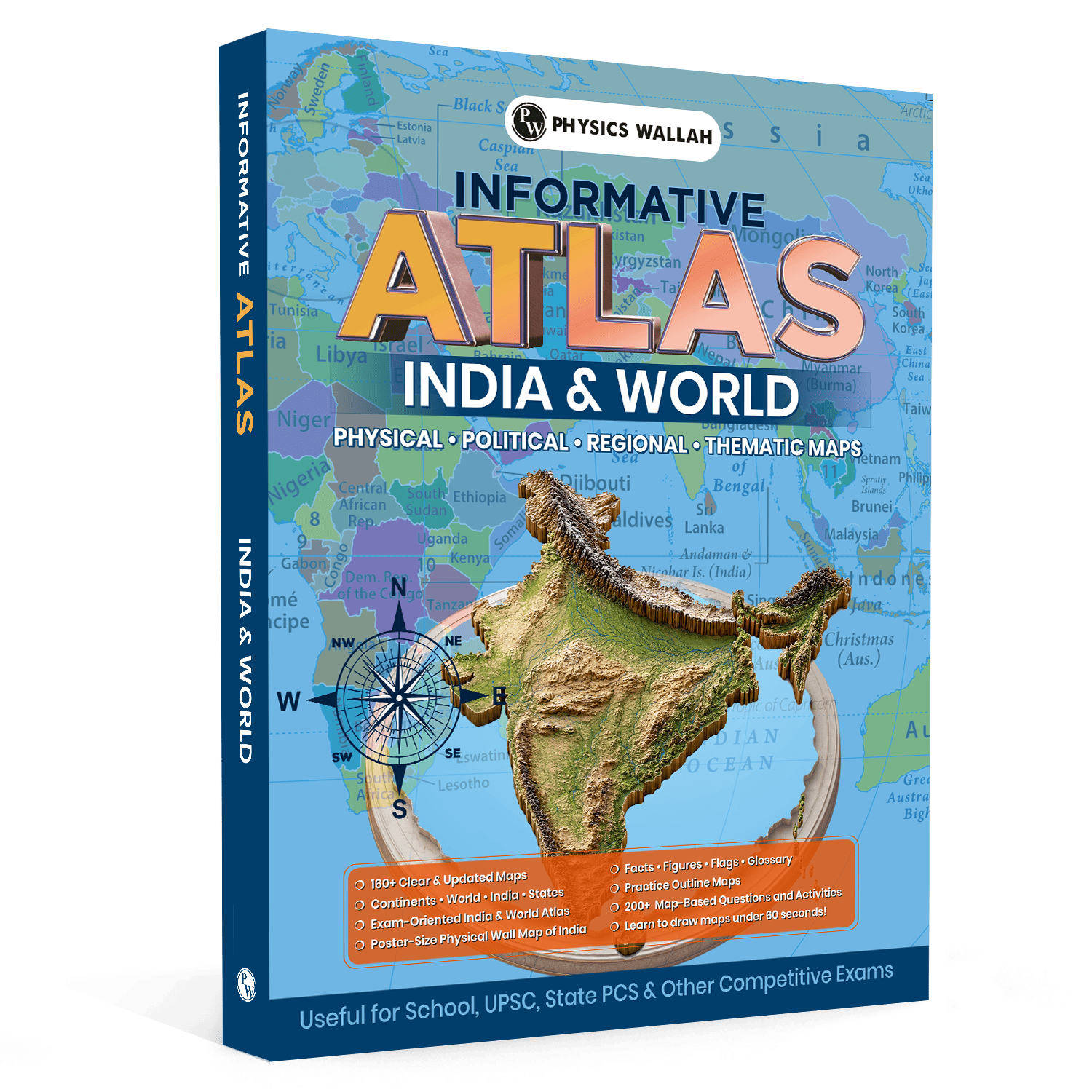
160+ Updated Maps: Offers a detailed collection of more than 160 clear, fully updated maps covering vital geographical concepts across India and the globe.
-
Comprehensive Coverage: Provides exhaustive details across continents, individual nations, Indian states, mountain ranges, vital rivers, vast deserts, major plateaus, and oceans.
-
Map Drawing Techniques: Teaches simple, structured methods to sketch critical Indian and global regional maps confidently in under 60 seconds.
-
200+ Practice Questions: Includes more than 200 map-based practice questions and interactive activities to systematically evaluate your progress.
-
Dedicated Glossary & Facts: Features a dedicated quick-reference section filled with geographical statistics, figures, national flags, and important terms.
-
Poster-Size Wall Map: Comes equipped with a large physical wall map of India to enhance long-term visual retention and daily revision.
Why Is Atlas for UPSC Helpful for UPSC 2026?
The examination landscape demands absolute precision when dealing with location-focused questions. Relying on an outdated UPSC Atlas book can lead to costly errors due to changing political boundaries or newly formed international corridors. The 2026 edition ensures your preparation aligns perfectly with current global realities.
Visual memory plays a massive role in retaining complex spatial information under examination pressure.
By utilizing this resource, you can easily contextualise dynamic current affairs, such as bilateral treaties, disputed border zones, or environmental crises, by anchoring them directly to their exact physical coordinates. This dual focus supports both factual accuracy for Prelims and conceptual depth for descriptive Mains answers.
Topics Covered in Atlas for UPSC
A comprehensive study tool must leave no gaps in the syllabus. This UPSC Revision book divides its vast geographical data into highly structured, accessible thematic segments.
|
Segment Type |
Key Subjects Covered |
Purpose & Focus |
|
Physical Geography |
Mountains, Rivers, Deserts, Plateaus, Oceans |
Understanding natural terrain, physical structures, and landforms. |
|
Political Geography |
International Boundaries, Continents, Countries, States |
Tracking geopolitical shifts, borders, and regional divisions. |
|
Statistical Data |
Geographical Facts, Figures, Historical Flags, Glossary |
Quick factual checks and data verification before the exam. |
How to Use Atlas for UPSC During Preparation
Maximising the utility of your Atlas for UPSC geography requires moving away from passive viewing towards active, hands-on learning. Start by keeping your reference book open whenever you read the daily newspaper or study standard GS text modules.
When you encounter a prominent location in a news report, immediately locate it in your reference book. Highlight the surrounding water bodies, neighboring nations, and key physical landforms.
Use the quick-reference glossary to cross-check relevant statistical facts and figures. This active habit transforms dry text into a vivid visual network, making it much easier to recall during the exam.
Study Plan for Using the Atlas for UPSC
To get the most out of your Atlas book for UPSC, you need a structured approach. The following weekly plan is designed to help you methodically cover the syllabus while building strong practical skills.
Phase 1: Foundations and Physical Layouts (Weeks 1–3)
Focus entirely on understanding natural landforms. Spend time identifying major mountain ranges, river systems, plateaus, and coastal features across India and the globe. Hang the provided poster-size wall map in your study area to build constant, passive visual familiarity.
Phase 2: Geopolitics and Quick Sketching (Weeks 4–6)
Shift your attention to international borders, country capitals, and disputed territories. Dedicate 15 minutes every day to practicing the 60-second map-drawing techniques. Being able to quickly sketch clean outline maps gives you a major advantage when illustrating your answers in the Mains exam.
Phase 3: Active Testing and Final Revision (Weeks 7–8)
Work through the 200+ map-based questions and practice activities to identify any gaps in your knowledge. Use the specialized factual sections and glossary to quickly review key details, flags, and figures right before the exam.
How to do Exam Practice with Atlas for UPSC?
True mastery comes from active self-assessment. Use this structured practice checklist alongside your UPSC PYQs book to test your spatial recognition and map-drawing speed.
-
60-Second Drills: Practice sketching an accurate outline map of India, marking its major river basins in under a minute.
-
Location Identification: Find and label five major global choke points, seas, and gulfs that have frequently appeared in recent global news.
-
Physical Feature Tracking: Trace the entire course of the major Himalayan and Peninsular rivers, noting their key tributaries and flow directions.
-
Question Bank Review: Complete at least 25 interactive questions from the book’s practice section every week to measure your progress.
Common Mistakes to Avoid While Using Atlas for UPSC
Many candidates miss out on the full value of their resources by falling into counterproductive study habits. Awareness of these common slip-ups will keep your preparation efficient.
-
Passive Reading: Memorising maps visually without practicing active sketching or taking notes significantly reduces your long-term retention.
-
Ignoring Current Events: Studying maps in isolation without linking them to current global events makes it much harder to tackle dynamic exam questions.
-
Neglecting the Exercises: Skipping the built-in map questions and activities leaves you unprepared for the specific way location questions are framed in the actual exam.
-
Relying on Loose Digital Files: Relying on unverified online files instead of a comprehensive, physical book can expose you to inaccurate boundaries and outdated information.
Read More: UPSC Prelims Geography Questions for 2026 Preparation
Atlas for UPSC FAQs
Q1: Can I successfully clear map questions using a digital Atlas for UPSC PDF?
While digital files offer portability, they lack the tactile benefits, large scaling, and ease of physical cross-referencing provided by a printed book. A high-quality physical version, complete with a large wall map, is highly recommended for building long-term visual memory and accuracy.
Q2: How many location-based questions appear in the civil services exam each year?
The number varies, but geography and map-linked current affairs consistently account for a significant portion of the Prelims paper. Additionally, illustrating your Mains answers with quick, accurate map sketches can noticeably improve your written scores.
Q3: Does this book cover both Indian and international geography completely?
Yes, the edition provides comprehensive coverage across both domains. It features dedicated sections for Indian states, rivers, and landforms, alongside complete political and physical breakdowns of global continents and oceans.