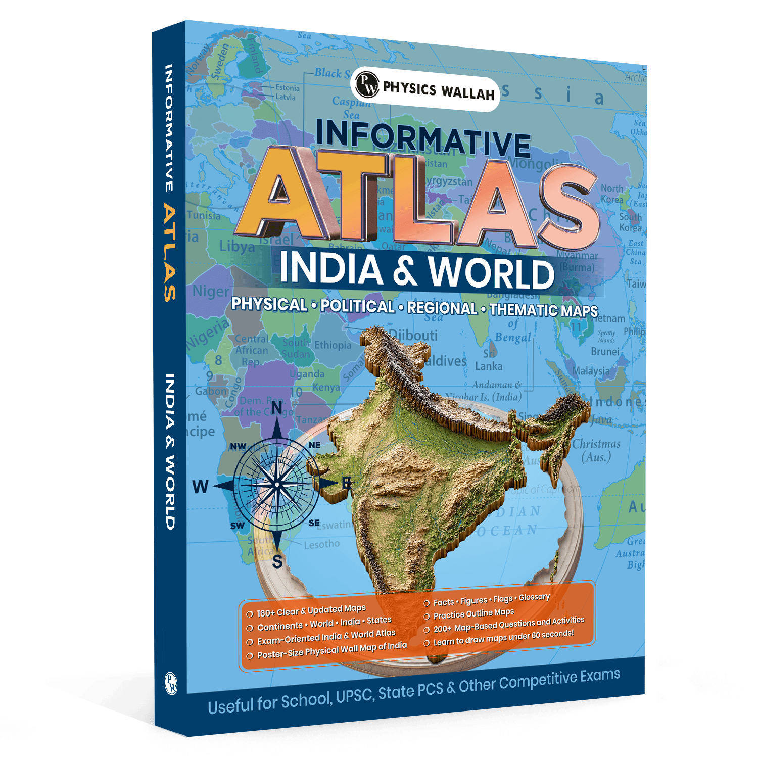
How PW Atlas Helps You Build Strong Geography Concepts

Many students find reading about physical landforms dry and confusing because they try to memorise locations from plain text. The real problem is a lack of spatial visualisation. Without a clear spatial reference, terms like "plateaus," "trench," or "isthmus" remain abstract ideas rather than real physical structures.
A quality atlas book for UPSC bridges this gap by turning complex regional data into a rich visual landscape. Visual learning improves memory retention and helps you understand how physical features shape geopolitical decisions.
This article explains how using a structured atlas improves your geographical concept building, helps you navigate map-based questions, and strengthens your preparation.
What Is an Atlas Book for UPSC?
An atlas book for UPSC is a specialized collection of physical, political, regional, and thematic maps designed specifically to meet the high standards of civil services examinations. Unlike a standard school atlas, it connects physical terrain with real-world current affairs.
This specialized resource stands out by focusing on:
-
Thematic Layouts: Maps that display agricultural patterns, mineral deposits, industrial zones, and climatic variations.
-
Detailed Regional Breakdowns: Close-up views of crucial international borders, shipping lanes, and disputed territories.
-
Visual Data Aids: Quick-reference charts, national flags, and precise physical features to build spatial awareness.
Why Is Atlas Book for UPSC Important for Geography?
Using an Atlas UPSC book is crucial for visualising the physical features that shape domestic and international policy. Reading about a mountain range is helpful, but seeing how it acts as a natural border gives you a much deeper structural understanding.
1. Enhances Spatial Visualisation
Our brains process visual information much faster than written text. Spotting active volcanic zones, tectonic plate boundaries, and major ocean currents on a map makes it easier to understand global environmental patterns.
2. Improves Location-Based Accuracy
Map-based questions in competitive exams often require precise location-based accuracy. Knowing whether a city lies north or south of a major river basin can be the difference between getting a question right or wrong.
3. Connects Current Affairs with Geography
Many international relations and environment questions are tied to specific locations. Finding places mentioned in the news on a world atlas for UPSC helps you understand the geographic reasons behind global conflicts and bilateral treaties.
To build a stronger foundation across Geography and other General Studies subjects, students can also use UPSC Books, which provide comprehensive subject-wise coverage, practice questions, and revision material aligned with the latest UPSC syllabus. Combining an atlas with structured UPSC books helps improve conceptual clarity, map-reading skills, and overall exam preparation.
Basic Geography Concepts Covered in Atlas Book for UPSC
Building a solid foundation starts with understanding the basic systems used in cartography. An atlas for UPSC simplifies these essential ideas so you can read any map with confidence.
|
Basic Geographic Concept |
Core Definition & Importance |
Map Representation |
|
Latitudes and Longitudes |
Grid lines used to pinpoint any location on Earth. Longitudes also help calculate local time zones. |
Indicated as numbered grid lines along the margins of physical and political maps. |
|
Contour Lines & Elevation |
Lines that connect points of equal elevation above sea level to show the shape of the land. |
Displayed using color gradients (browns for highlands, greens for lowlands) on physical maps. |
|
Map Scales |
The ratio of distance on the map to the actual distance on the ground. |
Shown as a linear scale bar at the bottom of each page to help calculate real-world distances. |
|
Map Legends & Symbols |
Key indicators that identify roads, boundaries, capital cities, and natural resources. |
A dedicated reference box on each map that defines the meaning of different colors and symbols. |
UPSC Revision Books provide concise subject-wise summaries, important facts, and exam-focused notes for quick and effective revision.
Designed for both Prelims and Mains, they help strengthen concepts, improve retention, and maximise productivity during the final phase of UPSC preparation.
What are the Topics Covered in the Atlas Book for UPSC?
A comprehensive atlas for UPSC geography covers all key physical and political areas of study. It organizes complex geographic features into distinct categories to make self-study straightforward.
1. Indian Physical Geography
This section covers India's diverse landscapes. It includes detailed maps of the Himalayan ranges, the Indo-Gangetic plains, the Deccan plateau, coastal plains, and island territories. It also highlights major river basins, drainage systems, and soil distribution.
2. Indian Political and Administrative Divisions
This section maps out state boundaries, Union Territories, capital cities, major transportation networks, and key infrastructure projects.
3. World Physical and Regional Geography
This part focuses on the global distribution of key physical features. You can explore:
-
Major mountain systems (the Andes, Rockies, Alps, and Himalayas).
-
Global river basins, major seas, gulfs, and ocean trenches.
-
Wind circulation patterns, climatic regions, and major vegetation zones.
4. Economic and Human Geography
These maps track global resource distribution, major mining areas, agricultural zones, industrial belts, and population density patterns.
How to Use the Atlas Book for UPSC?
Using an atlas effectively requires a structured approach. Simply flipping through pages will not help you retain information.
-
Start with the Legend: Always read the map key or legend first. Understanding what the symbols and colors mean keeps you from misinterpreting administrative boundaries or elevation levels.
-
Work from Large to Small Scales: Begin with a global map to understand the overall context before zooming into regional or state-level physical maps.
-
Practice Active Drawing: Do not just look at the maps. Use map drawing techniques to sketch simple outlines of countries, coastlines, or mountain ranges. Drawing these outlines by hand helps lock the spatial details into your long-term memory.
-
Cross-Reference with Textbooks: Keep your physical geography textbook open alongside your atlas. When you read about block mountains or rift valleys, find real-world examples of them on the map immediately.
Practise with the UPSC PYQ book featuring 3,400+ topic-wise previous year MCQs, detailed explanations, and trend analysis to strengthen your Prelims preparation and improve question-solving accuracy.
What Should be the Study Plan with the Atlas Book for UPSC?
To help you build a solid study routine, here is an organized six-week plan designed to integrate map studies into your daily prep.
Week 1: Basic Map Skills & Coordinates
Learn to read map scales, legends, and coordinate systems. Spend time finding major latitudes (like the Equator, Tropic of Cancer, and Tropic of Capricorn) and noting which countries they pass through.
Week 2: Indian Physical Features
Focus on the physical structure of India. Trace the Himalayas from west to east, locate major passes, and identify key mountain peaks.
Week 3: Indian Drainage Systems
Map out the major river basins. Trace the routes of both Himalayan and Peninsular rivers, and pay close attention to their left-bank and right-bank tributaries.
Week 4: Resources, Soils, and Agriculture
Study thematic maps showing soil types, mineral deposits, forest cover, and crop distribution across different Indian states.
Week 5: Global Physical Landscapes
Study the continents one by one. Identify their major mountain ranges, deserts, great lakes, and surrounding oceans.
Week 6: Practice and Revision
Spend this week taking practice tests and drawing quick outline maps to review what you have learned.
Stay updated with the UPSC Quarterly Current Affairs Combo 2026, featuring exam-focused coverage of important national and international events, government schemes, reports, and issue-based analysis to strengthen your UPSC Prelims and Mains preparation.
Practice Sheet For Atlas Book for UPSC
Active practice is key to mastering geography. Use this structured worksheet to test your spatial awareness and map-reading skills.
Exercise 1: Identify and Mark (India)
-
Mark the Standard Meridian of India (82°30′ E) on the map and identify the states through which it passes.
-
Locate and circle the three major western-flowing rivers of the Peninsular plateau.
-
Identify the state capitals that lie closest to the Tropic of Cancer.
Exercise 2: Global Connections
-
Locate the major choke points of global trade (the Strait of Malacca, the Strait of Gibraltar, the Bab-el-Mandeb, and the Suez Canal).
-
List the countries that border the Mediterranean Sea.
-
Identify the landlocked nations in South America.
Exercise 3: Quick Sketch Challenge
-
Try to draw an outline map of India in under 60 seconds, marking the correct locations of the Western Ghats, Eastern Ghats, and the Thar Desert.
Tips to Follow While Using the Atlas Book for UPSC
Using the Atlas Book for UPSC effectively can improve your map-reading skills and strengthen your understanding of geography-based topics. Following a structured approach helps you retain locations better and apply them confidently in the exam.
-
Keep a Poster Map on Your Wall: Hanging a physical wall map of India in your study space helps with passive learning. Looking at it during breaks naturally reinforces your spatial memory.
-
Use Color-Coded Pens: When practicing on blank outline maps, use blue for rivers and water bodies, brown for mountains, and green for plains.
-
Incorporate Maps into Your Answers: In written exams, drawing a neat, labeled sketch can make your answers stand out and earn you extra marks.
-
Stay Updated: Geopolitical boundaries and environmental statistics change. Make sure you are using an updated edition of your atlas to get the most accurate information.
Read More: Features of PW UPSC PYQ for 2026 Exam Preparation
Atlas Book for UPSC FAQs
Which atlas for UPSC is best for beginners?
A comprehensive atlas with clean, high-resolution maps of India and the world is ideal. Look for one that includes thematic maps, quick-reference tables, and practice questions to help build your skills.
How can I download an atlas for UPSC PDF for offline study?
While some online platforms offer digital resources, a physical atlas is highly recommended. Working with a physical book is much easier on the eyes during long study sessions and allows you to easily cross-reference multiple pages.
Are map-based questions common in the prelims?
Yes, map-based questions are a regular part of the prelims. They often ask you to arrange geographical features (like rivers or mountains) from north to south, or to identify places that have recently been in the news.