How to Use Atlas Indian Book Along With NCERT Books
Reading descriptive paragraphs without spatial visual context creates confusion and makes revision stressful. When preparing for major school or competitive examinations, relying solely on text is rarely enough to build clear spatial memory.
An UPSC Indian atlas book solves this exact problem by transforming abstract descriptions into detailed visual maps. By using an atlas alongside standard NCERT textbooks, you bridge the gap between theory and location accuracy, making your geography preparation far more efficient and memorable.
Overview of Indian Atlas Book Features
An Indian atlas book serves as a vital visual companion designed to bridge the gap between theory and geographic locations. It integrates detailed physical, political, and thematic mapping to build strong spatial awareness for students.
-
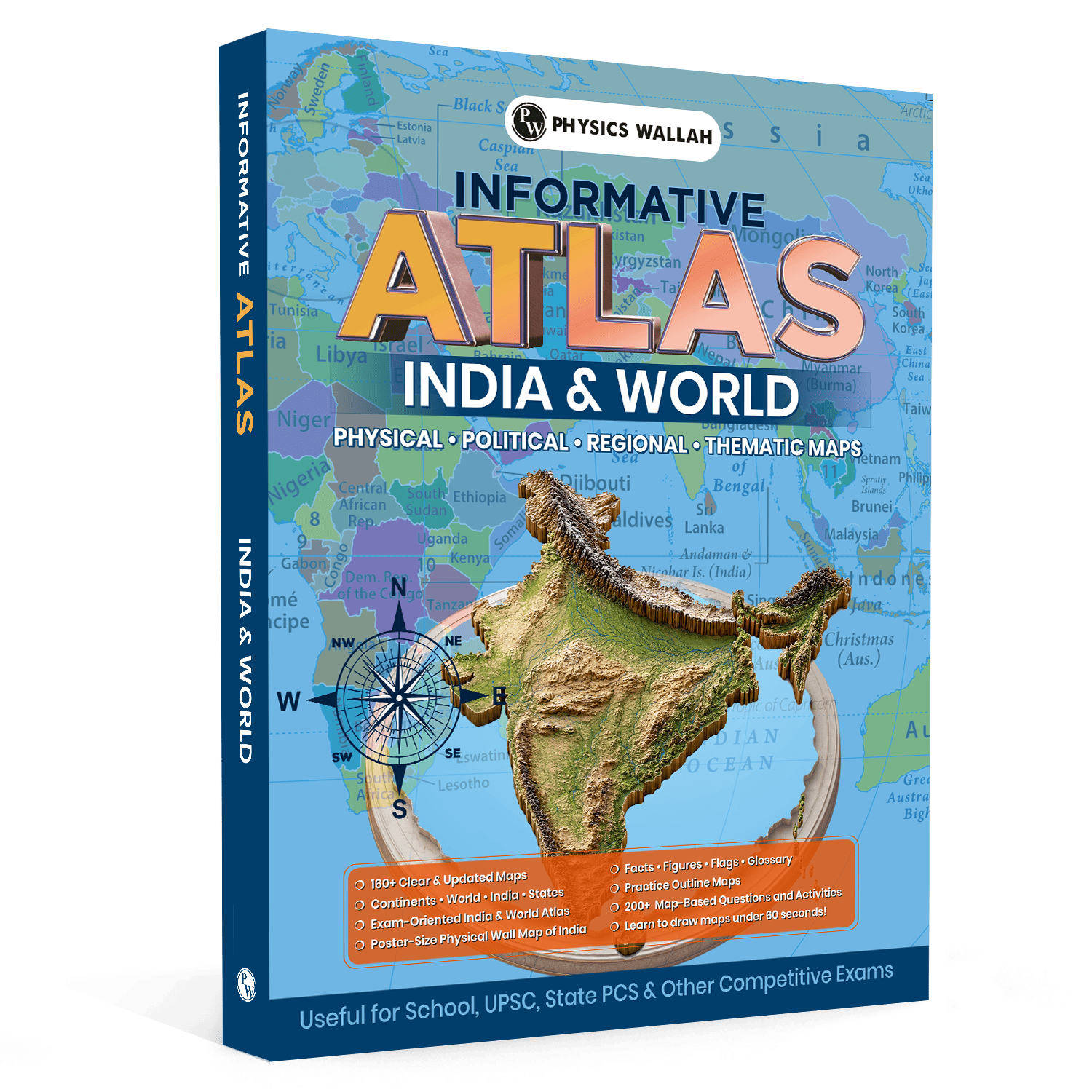
Extensive Map Coverage: Features over 160 updated maps detailing continents, countries, Indian states, physical relief features, and political boundaries.
-
Physical Wall Map Support: Comes with a poster-size physical wall map of India to support continuous visual learning and quick daily revision.
-
Quick-Reference Glossaries: Includes dedicated sections containing geography facts, statistics, national flags, key location data, and terms for last-minute revision.
-
Map Drawing Techniques: Offers simple step-by-step methods to help students learn to draw accurate India and world maps in under 60 seconds.
-
Practice Modules: Contains more than 200 map-based questions, outline maps, and interactive activities to test retention and location accuracy.
Why Pair an Indian Atlas Book With NCERTs?
Studying NCERT chapters alongside an Indian atlas book shifts your preparation from passive reading to active learning. NCERTs explain the theoretical processes behind landforms, climate, and resources, while the atlas provides spatial orientation.
-
Enhanced Retention: Visualizing mountains, rivers, and boundaries on a geography map UPSC book creates stronger neural pathways than reading plain text alone.
-
Location Accuracy: Developing precise spatial recognition is essential when handling location-based questions in competitive exams.
-
Comprehensive Exam Readiness: Combining text with maps supports both basic conceptual learning for school exams and detailed analytical preparation required for an atlas for UPSC.
-
Active Revision: Using outline maps alongside textbook chapters helps you test your memory immediately after completing a topic.
Main Topics Covered in Indian Atlas Book
A standard Indian atlas book organizes geographic information systematically to complement your syllabus requirements across physical, political, and economic domains.
|
Geographic Category |
Specific Topics & Features Included |
|
Physical Features |
River systems, mountain ranges, plateaus, deserts, coastal plains, oceans, and relief gradients. |
|
Political Boundaries |
State boundaries, union territories, international borders, capital cities, and major urban centres. |
|
Economic Geography |
Mineral distribution, soil types, natural vegetation zones, major industrial belts, and transport networks. |
|
World Geography |
Continent profiles, global ocean currents, major mountain belts, straits, and key geopolitical regions. |
|
Supplementary Facts |
Flag directories, demographic statistics, regional glossaries, and practice outline maps. |
When to Open Your Indian Atlas Book?
Integrating an UPSC atlas book and UPSC Revision Books into your daily schedule requires exact timing during your reading sessions. Opening your atlas at the right moments ensures your studying remains focused and helps reinforce important concepts.
-
During First NCERT Readings: Whenever a chapter mentions a river, mountain peak, or boundary, look it up instantly in your atlas to establish a clear visual reference.
-
While Solving Practice Questions: Work through your NCERT and atlas for UPSC preparation by attempting map-based exercises immediately after completing a chapter.
-
During Daily Revision: Use the included poster-size wall map for 10-minute daily spot-checks on location coordinates and neighbouring regions.
-
While Tracking Current Events: Whenever news reports highlight global or national locations, locate them on your map to build real-world spatial awareness.
How to Read an Indian Atlas Book With NCERT
To gain maximum value from your Indian atlas book, avoid flipping through pages aimlessly. Follow a structured approach to link textbook information directly to map locations.
-
Keep Books Side by Side: Place your NCERT textbook on one side and your atlas on the other before you begin reading.
-
Trace Features Physically: Use your finger or a stylus to trace river pathways from their source to the sea as you read about them in the text.
-
Cross-Reference Details: Compare physical maps with political maps to understand which states or districts share specific landforms or rivers.
-
Practice Quick Drawing: Use the 60-second map-drawing guidance to sketch outline maps on paper while taking notes.
-
Mark Key Locations: Highlight crucial mountain passes, mineral belts, or national parks directly on practice outline maps.
How to Create a Study Plan with Indian Atlas Book and NCERT?
Structuring your study schedule ensures balanced coverage across all chapters. A well-planned timetable prevents map practice from being pushed aside during heavy reading days.
-
Phase 1 (Basic Physical Mapping): Pair introductory NCERT chapters with physical maps of India, focusing on mountain ranges, rivers, and plateaus.
-
Phase 2 (Political & Administrative Focus): Study political divisions, state borders, capital locations, and international boundary lines using your India map book.
-
Phase 3 (Economic & Human Geography): Match agriculture and industrial chapters with thematic maps showing crop belts, soil distribution, and mineral reserves.
-
Phase 4 (World Geography Integration): Move to regional maps of continents and global features while studying world physical geography topics.
-
Phase 5 (Testing & Revision): Allocate dedicated time to attempt the 200+ practice questions and outline exercises provided in the atlas.
Mistakes to Avoid with Indian Atlas Book and NCERT
Many students fail to get the most out of their Indian atlas book because of simple study habits that reduce efficiency.
-
Treating Map Reading as Optional: Skipping maps during initial chapter readings creates gaps in your spatial understanding.
-
Memorising Without Spatial Context: Trying to rote-memorise lists of tributaries or state borders without checking their actual positions on a map.
-
Overcrowding Notes: Writing extensive text on outline maps instead of using clean symbols, color codes, and simple labels.
-
Ignoring World Maps: Focusing exclusively on Indian geography atlas sections while ignoring global physical features, oceans, and straits.
-
Delaying Practice: Leaving map exercises until right before exams rather than practicing regularly throughout your study term.
Get exam-oriented practice with UPSC Previous Year Papers from PW. Solving past papers helps aspirants analyse question trends, understand the UPSC's approach, identify high-priority topics, and assess their preparation under realistic exam conditions.
Practical Tips to Combine Indian Atlas Book with NCERT
Combining textbook concepts with visual maps becomes natural once you build simple daily study habits.
-
Use Sticky Notes for Cross-Referencing: Write down atlas page numbers directly next to topics in your NCERT margins for fast reference later.
-
Leverage the Wall Map: Mount the poster-size physical map near your study table to keep major geographical features in view throughout the day.
-
Master 60-Second Sketches: Practice drawing rough India outlines regularly so you can sketch clean maps during time-bound tests.
-
Work with Blank Outline Maps: Test your recall after completing every chapter by plotting key features onto blank outline sheets without looking at the atlas.
-
Focus on Spatial Relationships: Notice which tropic lines pass through specific states or which river basins cross multiple regional boundaries.
Read More: UPSC Previous Year Question Papers PDF
Indian Atlas Book with NCERT FAQs
Why is an Indian atlas book necessary alongside NCERT textbooks?
NCERT textbooks provide foundational conceptual text, while an Indian atlas book offers essential visual maps that help build spatial memory, precise location accuracy, and better retention.
How does an atlas for UPSC help in competitive exam preparation?
An atlas for UPSC provides detailed coverage of physical landforms, political boundaries, mineral locations, and over 200 map-based practice questions essential for Prelims and Mains exams.
Can I draw accurate maps quickly using a geography map book?
Yes, quality atlases provide dedicated map-drawing techniques that teach students how to sketch clear, accurate outlines of India and world maps within 60 seconds.
Is studying an Indian geography atlas enough for world geography topics?
An Indian geography atlas section builds strong domestic knowledge, but students must also use the world map sections covering continents, oceans, and global features for complete exam readiness.
What is the best way to combine ncert and atlas for UPSC revision?
Keep your ncert and atlas for UPSC side-by-side while studying, trace features physically as you read, and immediately test yourself using blank outline maps and practice exercises.